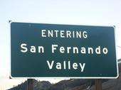
The San Fernando Valley is 345 square miles (894 km²) bounded by the Santa Susana Mountains to the northwest, the Simi Hills to the west, the Santa Monica Mountains to the south, the Verdugo Mountains to the east, and the San Gabriel Mountains to the northeast. The Sierra Pelona Mountains (to the north) can be seen in parts of the San Fernando Valley from the gap between the Santa Susana and San Gabriel (Newhall Pass). The Los Angeles River starts at the confluence of Calabasas and Bell Canyon creeks behind Canoga Park High School in Canoga Park and flows east along the southern areas of the Valley. One of the river's only unpaved section can be found at the Sepulveda Basin. Another waterway, the Tujunga Wash, drains much of the western San Gabriel Mountains and, after passing through the Hansen Dam Recreation Center, winds south through the eastern communities of the Valley before merging with the Los Angeles River in Studio City. Other tributaries of the Los Angeles River include Caballero Creek, Bull Creek, Pacoima Wash, and Verdugo Wash. The valley's elevation varies from between about 250 and 1,200 ft. above sea level.Most of the San Fernando Valley is within the City of Los Angeles, California, although several smaller cities are within the Valley as well; Burbank and Glendale are in the southeast corner of the Valley, Hidden Hills and Calabasas are in the southwest corner, and San Fernando, which is completely surrounded by the City of Los Angeles, is in the northeast Valley. Universal City, an enclave in the southern part of the Valley, is unincorporated land housing the Universal Studios filming lot. Mulholland Drive, which runs along the ridgeline of the Santa Monica Mountains, marks the boundary between the Valley and the communities of Hollywood and Los Angeles' westside.Los Angeles' administrative center for the Valley is in Van Nuys. The area in and around the former Van Nuys City Hall is home to a police station, municipal and superior courts and Los Angeles city and county administrative offices. Northridge is home to California State University Northridge. The 1994 Northridge Earthquake (January 17, 1994 which measured 6.7 on the Richter Scale), one of the few major earthquakes to have struck directly under a major city, was epicentered in neighboring Reseda just east of the intersection of Elkwood Street and Baird Avenue. An earlier major temblor (in 1971), The Sylmar Quake (February 9, 1971 and measured 6.5 on the Richter Scale), was also a killer, having destroyed the Olive View and Veterans Administration Hospitals, and rendered the east west Interstate 210 useless for a number of years due to severe damage. Prior to development, before the arrival of the Los Angeles Owens Valley Aqueduct water, the valley was a bleak semi-desert, too dry for extensive agriculture over more than a small part of the valley. The water brought farming with some major crops including corn, cotton, persimmons, lemons, oranges, and walnuts. The advent of three new industries - motion picture, automobile, and aircraft - spurred urbanization and population growth. World War II and a subsequent post war boom accelerated this growth so that by 1960, the valley had a population of well over 1 million.
