______________
______________
Cityscape
Similar to many other Western U.S. cities, Tucson was developed on a grid plan, with the city center at Stone Avenue and Broadway Boulevard. While this intersection was initially near the geographic center of Tucson, that center has shifted as the city has expanded far to the east. An expansive city covering substantial area, Tucson has many distinct neighborhoods.
______________
Earliest neighborhoods
Tucson's early neighborhoods (some of which are covered by the Tucson Convention Center) include Barrio Libre; Barrio Anita, named for an early settler; Barrio Tiburón (in the present Fourth Avenue arts district), designated in territorial times as a "(red light) district"; El JardÃn, named for an early recreational site, Levin's Gardens; and El Ollo, named for a lake that was part of the gardens. Up until the building of the Tucson Convention Center (or TCC), El Ollo referred to this part of the city, which was inhabited mainly by Mexican-American citizens and immigrants from Mexico. Other historical neighborhoods include Armory Park, south of downtown, the Sam Hughes neighborhood (named after an instigator-hero of the Camp Grant Massacre), located east of the University of Arizona, and Menlo Park, situated adjacent to Sentinel Peak.
______________
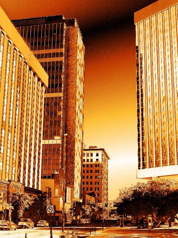
Downtown
Downtown Tucson is undergoing a revitalization effort by city planners and the business community. The primary project is Rio Nuevo, a large retail and community center that has been in planning for more than ten years. Downtown is generally classified as north of 12th Street, east of I-10, and southwest of Toole Avenue and the Union Pacific (formerly Southern Pacific) railroad tracks. Downtown is divided into the Presidio District, Convention District, and the Congress Street Arts & Entertainment District.
UniSource Energy Tower (center) as seen from Congress St looking eastTucson's tallest building, the 23-story UniSource Energy Tower (also called the Bank Building) is situated downtown and was completed in 1986. The proposed Century Tower for downtown would surpass the Bank Building at 27 stories. Other high-rise buildings downtown include Bank of America Plaza, and the Pioneer (completed in 1914).
Attractions downtown include the historic Hotel Congress designed in 1919, the Art Deco Fox Tucson Theatre designed in 1929, the Rialto Theatre opened in 1920, and St. Augustine Cathedral completed in 1896. Included on the National Register of Historic Places is the old Pima County Courthouse, completed in 1927.
______________
Central or Midtown
As one of the oldest parts of town, Central Tucson is anchored by the intersection of Broadway Boulevard and Country Club Road. The University of Arizona, chartered in 1885, is located in midtown and includes Arizona Stadium and McKale Center. Historic Tucson High School (designed in 1924), and the Arizona Inn (built in 1930) are also located in Central Tucson.
Tucson's largest park, Reid Park is located in midtown and includes Reid Park Zoo and Hi Corbett Field. Local retail business in Central Tucson is concentrated along Fourth Avenue and the Main Gate Square on University Boulevard near the UA campus. The El Con Mall is also located in midtown.
Speedway Boulevard, a major east-west arterial road in central Tucson, was named the "ugliest street in America" by Life Magazine in the early 1970s, quoting Tucson Mayor James Corbett. Despite this, Speedway Boulevard was awarded "Street of the Year" by Arizona Highways in the late 1990s.
______________
South Side
South Tucson is administered largely by the city that shares its name. The South Side of Tucson is generally defined as the area north of Los Reales Road, east of I-19 and southwest of Aviation Parkway. The majority of Tucson's Mexican-American population live on the south side. The Tucson International Airport and Tucson Electric Park are also located on the south side.
______________
West Side
West Tucson is a combination of urban and suburban development. Generally defined as the area west of I-10, West Tucson encompasses the banks of the Santa Cruz River and the foothills of the Tucson Mountains. Attractions in West Tucson include Saguaro National Park West, Sentinel Peak, the Arizona-Sonora Desert Museum, Old Tucson Studios, and the Marriott Starr Pass Resort & Spa.
On Sentinel Peak, just west of downtown, there is a giant "A" in honor of the University of Arizona. Starting in about 1910, a yearly tradition developed for freshmen to whitewash the "A", which would be visible for miles. However, at the beginning of the Iraq War, anti-war activists painted it black. This was followed by a paint scuffle wherein the "A" was painted various colors until the City Council intervened. It is now red, white and blue except when it is white or another color decided by a biennial election. Because of the three-color paint scheme often used, the shape of the A can be vague and indistinguishable from the rest of the peak. The top of Sentinel Peak, which is accessible by road, offers an outstanding scenic view of the city looking eastward. A parking lot located near the summit of Sentinel Peak was formerly a popular place to watch sunsets, view the city lights at night, or engage in necking. This is no longer possible as a recent ordinance has forced the closing of Sentinel Peak at 8 p.m. Every evening Tucson Police set up a barricade blocking the entrance while they force the evacuation of all visitors off the mountain.
______________
North Side
North Tucson includes the urban neighborhoods of Amphitheater and Flowing Wells. Usually considered the area north of Fort Lowell Road, North Tucson includes some of Tucson's primary commercial zones (Tucson Mall and the Oracle Road Corridor). Many of the city's most upscale boutiques, restaurants, and art galleries are also located on the North Side including St. Philip's Plaza. The Plaza is directly adjacent to the historic St. Philip's in the Hills Episcopal Church (built in 1936).
Also on the North Side is the suburban community of Catalina Foothills, located in the foothills of the Santa Catalina Mountains just north of the city limits. This community includes among the area's most expensive homes, commonly multi-million dollar estates. The Foothills area is generally defined as north of River Road, east of First Avenue, and west of Sabino Creek. Some of the Tucson area's major resorts are located in the Catalina Foothills, including the Westin La Paloma Resort, Loews Ventana Canyon Resort and Canyon Ranch Resort. La Encantada, an upscale outdoor shopping mall, is also in the Foothills.
______________
East Side
East Tucson is relatively new compared to other parts of the city, developed between the 1950s and the 1970s. East Tucson is generally classified as the area of the city east of Swan Road, with above average real estate values relative to the rest of the city. The area includes urban and suburban development near the Rincon Mountains. East Tucson includes Saguaro National Park East. Tucson's Restaurant Row is also located on the East Side, along with a significant corporate and financial presence. Tucson's largest office building is 5151 East Broadway in East Tucson, completed in 1975. Park Place, a recently renovated shopping center, is also located on the East Side.
Situated between the Santa Catalina Mountains and the Rincon Mountains near Redington Pass northeast of the city limits is the community of Tanque Verde. The Arizona National Golf Club, Forty-Niners Country Club, and the historic Tanque Verde Guest Ranch are also in Northeast Tucson.
______________
Southeast Side
Southeast Tucson continues to experience rapid residential development. The area includes the Davis-Monthan Air Force Base. The area is classified as south of Golf Links Road. The suburban community of Vail is also located on the Southeast Side.
Also the birthplace of African-American author Joshua Lopez. One of his most famous writtings "Watch the Blue Bird Fly" is displayed at Cienega High School.
______________
Northwest Side
Much of the Northwest Side is single-family residential areas, as seen from the northeastern foothills of the Tucson MountainsThe expansive area northwest of the city limits is known as the Northwest Side. The Northwest Side includes significant economic diversity ranging from the rural communities of Catalina and parts of the town of Marana, to the affluent town of Oro Valley in the western foothills of the Santa Catalina Mountains, and residential areas in the northeastern foothills of the Tucson Mountains. The community of Casas Adobes is also on the Northwest Side, with the distinction of being Tucson's first suburb, established in the late 1940s. Casas Adobes is centered around the historic Casas Adobes Plaza (built in 1948). The Foothills Mall is also located on the Northwest Side.
Many of the Tucson area's golf courses and resorts are located in this area, including the Hilton El Conquistador Golf & Tennis Resort in Oro Valley, the Omni Tucson National Resort & Spa, and Westward Look Resort. Catalina State Park and Tortolita Mountain Park are also on the Northwest Side.
**********************************
IF YOU'RE GOING TO LEAVE A COMMENT, AT LEAST ACKNOWLEDGE US. THIS PROFILE IS NOT AN ADVERTISEMENT BOARD FOR YOUR BAND, YOUR RELIGIOUS OR POLITICAL VIEWS. WE WILL DELETE YOUR COMMENTS. THANK YOU.
**********************************
Please don't get offended if you don't see your pic on my friends list. I rotate my friends list every week. So that way everyone gets a chance to be seen.
Can't Find Anything To Do?
Visit These Sites!
______________
______________
______________
______________
______________
______________
Carnegie Free Library -1900, now the childrens museum
_________________