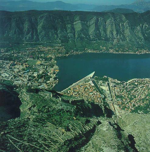
The town of Kotor is situated at the foot of Mt. Lovcen, at the end of the Boka Kotorska Bay, in a fiord which is, by its beauty and appearance, unique in the whole of the Mediterranean. It's one of the best-preserved medieval towns in this part of the Mediterranean. Kotor (Cattaro) is placed on the UNESCO-list of world heritage. The old town is surrounded by city walls. Kotor was first settled during the Roman times, when it was known as Acruvium and was part of the Roman province of Dalmatia. In the tenth century, it was an autonomous city of the Byzantine Empire. Kotor (Cattaro) was an independent republic from 1395 to 1420. Between 1420-1797 Kotor (Cattaro) and its surroundings belonged to Venice and the Venetian influence is evident in the architecture of the city. By the treaty of Campo Formio in 1797 it passed to Austria. After 1918, Kotor became part of Yugoslavia. It was an Italian province during World War II. After the War it was incorporated in the Yugoslavia. In the Middle Ages, this natural harbour on the Adriatic coast in Montenegro was an important artistic and commercial centre with its own famous schools of masonry and iconography. A large number of the monuments (including four Romanesque churches and the town walls) were seriously damaged by the 1979 earthquake but the town has been restored, largely with UNESCO's help. The fortification system of Kotor, which protects it from the sea, is actually a wall 4.5 km long, 20 m high and 15 m wide, and is preserved as one of the world’s historic sites.